This feature was contributed by Tour College Towns. Bloomington Online has not independently verified its claims.Current Indiana students show prospective and admitted families the campus and the college town around it.
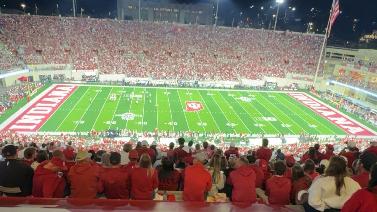
Part of what makes Indiana University special is where it is. Bloomington is a true college town. Kirkwood Avenue runs from the Sample Gates into downtown, lined with restaurants, coffee shops and local stores. Students live in the neighborhoods just off campus, Greek life is a big part of the social scene, and on fall Saturdays the whole town turns toward Memorial Stadium. For most IU students, Bloomington becomes as much a part of their four years as the classroom.
Memorial Stadium on a fall game night. Photo: Tour College Towns
Tour College Towns wants prospective and admitted students to see that side of IU before they decide. This fall, the company began offering private walking tours of campus and Bloomington, led by current Indiana students.
The idea behind the company is that students spend most of their time outside of class, and that time often shapes the college experience as much as anything else. Seeing the town along with the campus gives families a fuller picture of what daily life at IU will look like.
Honest and Built Around Each Family
Guides are current IU students who live this life every day. They don’t follow a script, and they aren’t there to sell anyone on the school. The goal is to provide honest answers about dorms, classes, housing, Greek life and what a normal week looks like, so families can make their own decision. Tour College Towns is independent of the university.
No two tours are the same. Before the visit, families share what matters most to them, and their guide plans the route around it. One family might want to see the Kelley School, Greek Row and the neighborhoods where upperclassmen rent. Another might care most about dorms, Kirkwood and where students spend their weekends. Families are matched with the guide closest to their student’s major and interests, and tours run seven days a week, early or late, around each family’s visit.
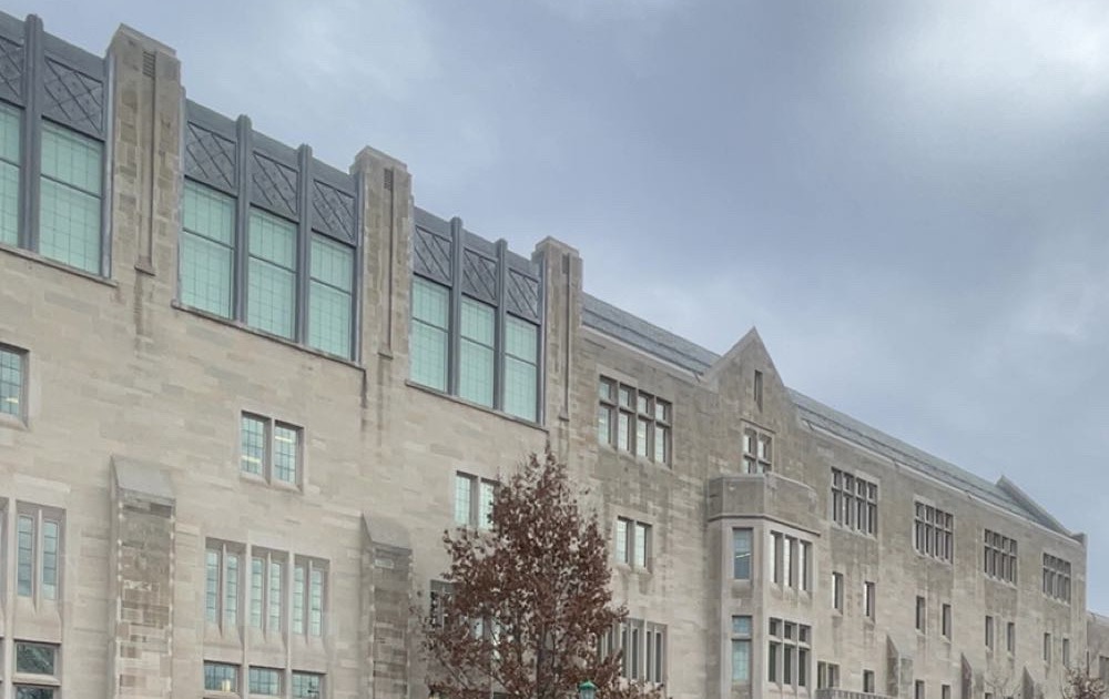
Limestone buildings line the streets around the IU campus. Photo: Tour College Towns
The tours are meant to add to the official IU campus visit, not replace it. The company’s advice to families is to do both if they can.
Why Families Find It Worth It
A private tour costs $150 for the whole group, not per person, and runs 60 to 90 minutes. For many families, the value shows up long after the visit is over.
Off-campus housing is a good example. Many IU students eventually move off campus, and knowing which neighborhoods students prefer, when the housing search usually starts and what to look out for can save a family real stress and money down the road. The same goes for the inside knowledge guides share about Greek recruitment, getting involved, choosing classes and settling into a new town. Small pieces of advice from a student who is a year or two ahead can pay dividends over four years.
Prospective students get a real feel for Bloomington before they apply or commit. Admitted students get a head start on the practical questions that come up before move-in. And every family leaves with a current IU student they can reach out to as new questions come up.
Jobs for IU Students and Traffic for Local Businesses
The company is also creating work for IU students. Guides get paid to show families a school and town they care about, with flexible hours that fit around class and real experience helping build a growing startup. Tour College Towns is hiring guides in Bloomington now, and IU students can apply at tourcollegetowns.com/guides.
Every tour also walks families down Kirkwood and past Bloomington’s shops and restaurants. Out-of-town visitors leave knowing where to eat and spend time when they come back for move-in, Parents Weekend and game days.
Where It Started
Tour College Towns began at the University of Colorado Boulder, where student guides have helped more than 200 prospective students, families and alumni and earned more than 40 five-star Google reviews. Bloomington is the company’s next college town.
Families who can’t visit yet can schedule a 30-minute video call with a current IU student for $50, and custom group tours are available. More information is at tourcollegetowns.com/indiana-university.
About Tour College Towns
Tour College Towns offers private, student-led walking tours that go beyond campus into the college town. Tours are led by current students and shaped around what each family wants to see. Tour College Towns is independent and is not affiliated with, endorsed by or sponsored by Indiana University. Learn more at tourcollegetowns.com.
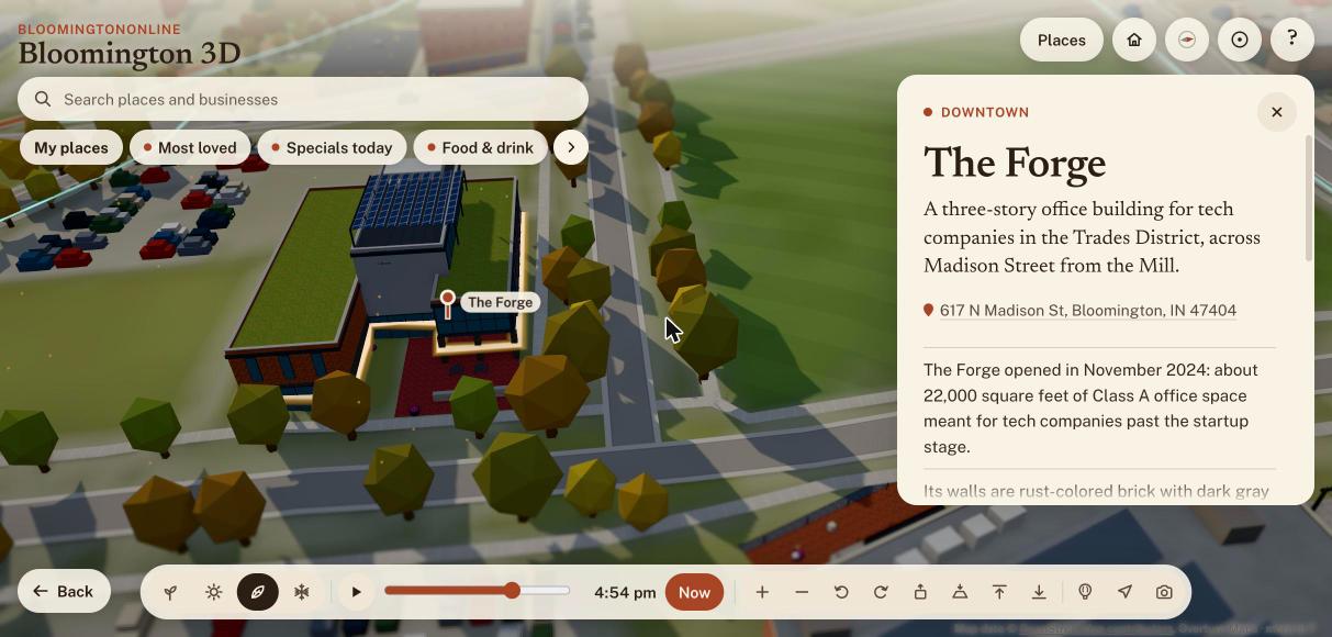
The map has a new building on it, and I had to come up with a pun to match: The Forge, the office building across from The Mill in the Trades District, is now on Bloomington 3D. This weekend, working with Claude Code, we also added pickleball courts and Indiana University’s campus to the map, built a tour of the city’s international markets, redesigned the Monday email, gave the events page filters, and cleaned up a few dozen directory listings. This week’s featured business is Amplify Bloomington, which happens to sit across the street from The Forge. Here is everything we forged, with the screens to show it.
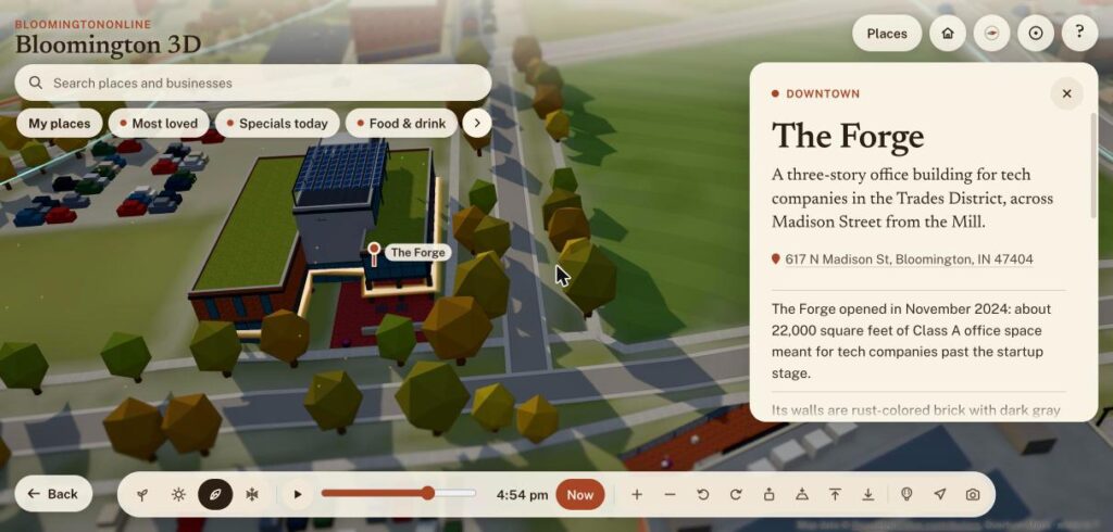
The Forge opened in November 2024 at 617 N. Madison Street, across Madison from The Mill. It is a three-story office building, about 22,000 square feet, meant for tech companies that have outgrown the startup stage. Folia was its first tenant, and Bloom and ViVum AI were named among the first companies to move in. It has a green roof and a rooftop solar array that was expected to cover nearly 30 percent of its electricity.
The Forge on the 3D map, with its green roofs, the solar canopy on top and the paved patio out front.
Most buildings on the map come from a lidar survey of the county. The Forge went up after that survey, so the map had nothing to start from. I sent photos I took standing in front of it, and Claude found the building in recent aerial imagery and traced its outline. Google’s own pin for the building lands inside that outline. The rust-colored brick, the glass box over the entrance, the gray tower with the Bloom sign, the solar canopy and the concrete sign wall out front all come from those photos.
I should be honest about the limits. The heights are estimates read from the photos, and I did not photograph the west or south sides, so those walls are best guesses. The card says so. If you work in the building and see something off, tell us and we will fix it. Earlier in the day we also made The Mill’s sign light up after dark and before dawn, so the two buildings now glow across the street from each other.
This week’s featured business: Amplify Bloomington
Amplify Bloomington is the Business of the Week on the homepage. It grew out of The Mill and describes itself as a civic alliance that supports regional entrepreneurship and innovation. Its coworking space is in the Trades District, and it helps local founders with scaling, access to capital and mentorship. It also connects Indiana University research with local employers and city leadership. Two people loved its listing this week.
If you are starting something, or you work for yourself and want a desk and some company, it is worth a visit. The listing has its contact details, and its card on the 3D map sits right across the street from The Forge.
One more change goes with it. When the map has nothing else to feature, such as a game or a concert, it now opens on the Business of the Week instead of the courthouse square. Today that means it opens on Amplify.
A tour of Bloomington’s international markets
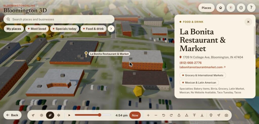
The Indiana Daily Student published a guide to the city’s international groceries and markets this summer, and it made a good map. There is now a guided tour with eleven stops: La Bonita, World Foods, Kabul Corner, 4th Street International, Little Italy Market, Btown Bodega, La Bodega, Olive Leaf, Apna Bazaar, Rong Cheng and B-Town International Market. Each stop has its own card, and the grocery and specialty food pages in the directory now point to the tour.
La Bonita Restaurant & Market on the international markets tour, with its address, phone number and specialties.
A redesigned Monday email, and an events page you can filter
The weekly email has a new look. Each event has a logo or a letter badge, a short description and add-to-calendar links for Google and for Apple and Outlook. Repeating events are folded into one line. The email you get when you sign up is designed now too, and so are the pages you land on when you confirm or unsubscribe. We also made those links safer: some mail programs open every link in a message to scan it, which could have unsubscribed people on its own. The links now show a button first, and only the button does anything.
Behind the scenes there is a new page for me under Tools called Weekly email, with the subscriber list, a send history, a preview and a test send. The next email goes out Monday morning at 8:00.
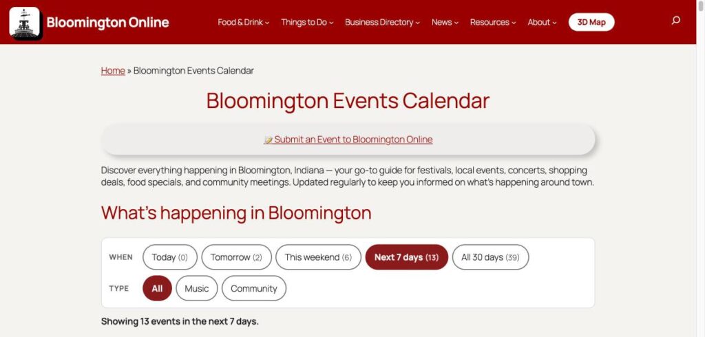
The events page got the same treatment. It shows the next 30 days from our public calendars, and you can narrow it by when (today, tomorrow, this weekend, next 7 days) and by type (music or community). Each event has an add-to-calendar link and a link to its place on the map. The homepage card uses a compact version of the same list.
The events calendar with its new filters for when and what kind of event.
Yesterday: pickleball courts, and all of Indiana University
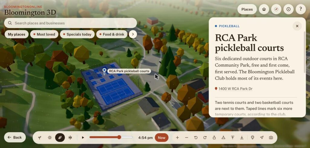
Sunday was a big day for the map. Pickleball and tennis courts are now drawn in 3D, with painted lines, nets, fences and light poles. RCA Park has its six pickleball courts, two tennis courts and the woods around them, and the Switchyard Park courts have string lights. Karst Farm, Park Ridge East and the IU Northwest courts are there too. We only drew courts we could confirm, so a few places that looked like courts on a satellite photo were left off.
RCA Park’s six pickleball courts and two tennis courts on the map.
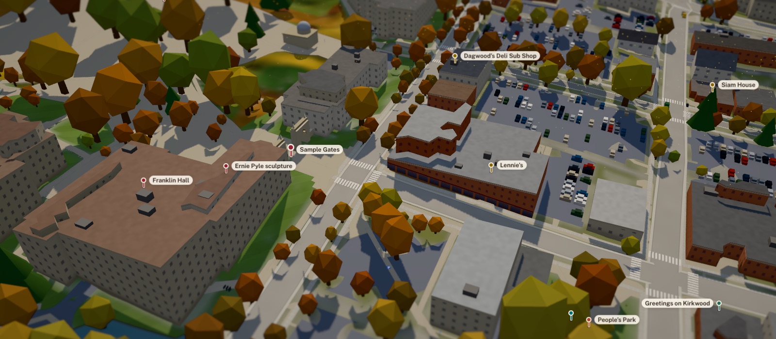
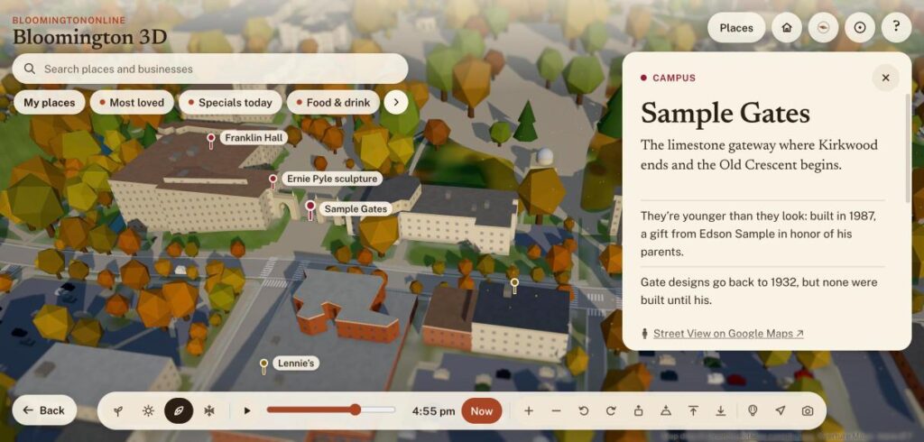
The bigger project was Indiana University. The map now has 26 more campus places, including the Indiana Memorial Union, Ballantine Hall, Franklin Hall, IU Cinema and the Hoagy Carmichael sculpture, with notes in our own words from IU’s public campus map. There are three campus tours based on IU’s own routes. The campus itself got paved: walkways and plazas, parking lots, bike racks, emergency phones that glow at night, and signs for accessible entrances and parking, all taken from IU’s public map data.
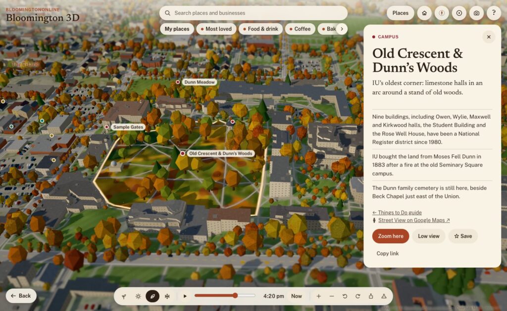
The Sample Gates and the Old Crescent on the map, with nearby campus stops labeled.
Any business or place that is a stop on a tour now says so on its directory page, with a button that flies the map to it. The Bluebird’s card also has a new button, See who’s playing, that flies up to its marquee.
Cleaning up the directory
We kept going on the directory refresh this weekend. We rewrote and fact-checked the listings for The Sip, Atlas, Blockhouse, Soma and its sister businesses, Bethel Lane Farm Stop and the five international markets, working from each business’s own website. We merged duplicates, moved listings out of categories that did not fit, removed a few we could not verify, and corrected addresses. We also added Enrich Barbershop at 126 E. 6th Street, a new listing.
As before, anything we could not confirm we left alone. A wrong phone number costs a local business a customer, so we would rather leave a listing thin than guess.
If you own a business here
Look yourself up in the directory and tell us what is wrong. Every page has a Suggest a correction link. If you have photos or changed hours, send them in. If you do not have a listing yet, adding one is free.
Two days ago there was no 3D Bloomington. Now there’s one you can fly around, from the copper fish on the courthouse to the sailboats on Lake Monroe. It’s built from real survey data, it lights up at dusk, it changes with the seasons, and every business in our directory can show up on it. Here’s what we built, where the data came from, and how it came together.
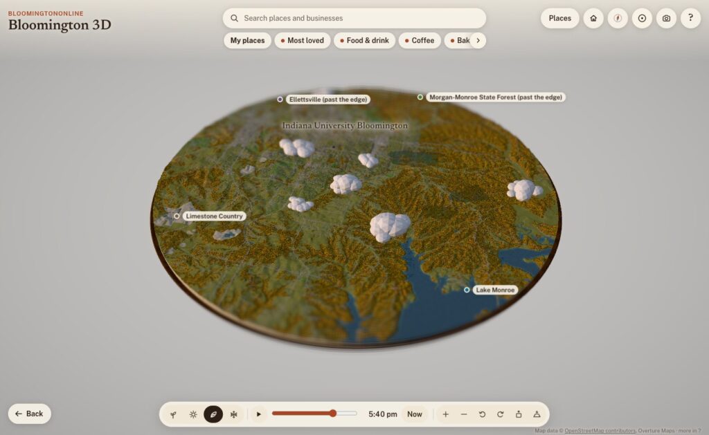
The whole board: Bloomington and the hills around it, about 12 miles across, on a fall evening.
What it is
Bloomington 3D is a model of Bloomington and the country around it: a round board about 19 kilometers (12 miles) across, centered just south of downtown, sitting on a walnut plinth like a museum diorama. The cut edge shows layers of limestone, and where the board slices through Lake Monroe you can see the water in cross-section.
It runs in any modern browser, on a phone or a computer, with nothing to install. It opens on the Courthouse Square. Drag to move, pinch or scroll to zoom, and tap anything outlined, pinned or named to read about it. Each place has a card with a short, fact-checked write-up, nearby places to wander to next, and a link you can share. For example, bloomingtononline.com/town/#griffy opens straight onto Griffy Lake.
Where the town comes from
None of the geography is drawn by hand. Every street, building, tree and creek comes from public data, and the map credits each source on screen. Here’s what’s in it.
Streets, buildings and paths: OpenStreetMap
The base layer is OpenStreetMap, the volunteer-built map of the world. It supplies the roads, the B-Line and the other trails, the creeks, parks, rail lines and building footprints. It also has the small things you notice once you zoom in: about 2,900 sidewalk segments and 4,300 other footpaths, crosswalks, bike lanes, benches, bike racks, picnic tables and parking lots, which fill up with little parked cars.
The hills: USGS elevation data
Southern Indiana isn’t flat, and the model shouldn’t be either. The terrain comes from USGS elevation data via open terrain tiles, with the hills exaggerated about two times so the ridges and hollows read at a glance, the way a museum diorama does. Buildings and trees stand at their real heights. Where OpenStreetMap doesn’t map the woods, the model fills undeveloped slopes with forest, because that’s what our hollows are.
Real building heights: 154 million laser points
This is the part I’m proudest of. Indiana was flown with lidar between 2017 and 2019 for the USGS 3D Elevation Program: an airplane sweeps a laser across the ground and records where every pulse bounces back. We streamed the 21 tiles that cover downtown, campus, Prospect Hill, Elm Heights, Bryan Park and the near west side, which is 154.6 million points, and turned them into a one-meter grid of the town.
From that grid, the model measures:
the eave and ridge height of 11,565 buildings, so roofs are the right height and the right shape
stepped roofs on bigger buildings, traced in tiers every 3.5 meters, so a building with a tall section and a low wing looks like that
towers that rise above the rest of a building
the tree canopy, so the woods and big yard trees stand where they really are
the bare ground under it all, more detailed than the terrain everywhere else
Outside that core, building heights come from Microsoft’s machine-learning estimates, published through Overture Maps, which also fills in buildings OpenStreetMap doesn’t have yet. All told, there are about 35,000 buildings on the board.
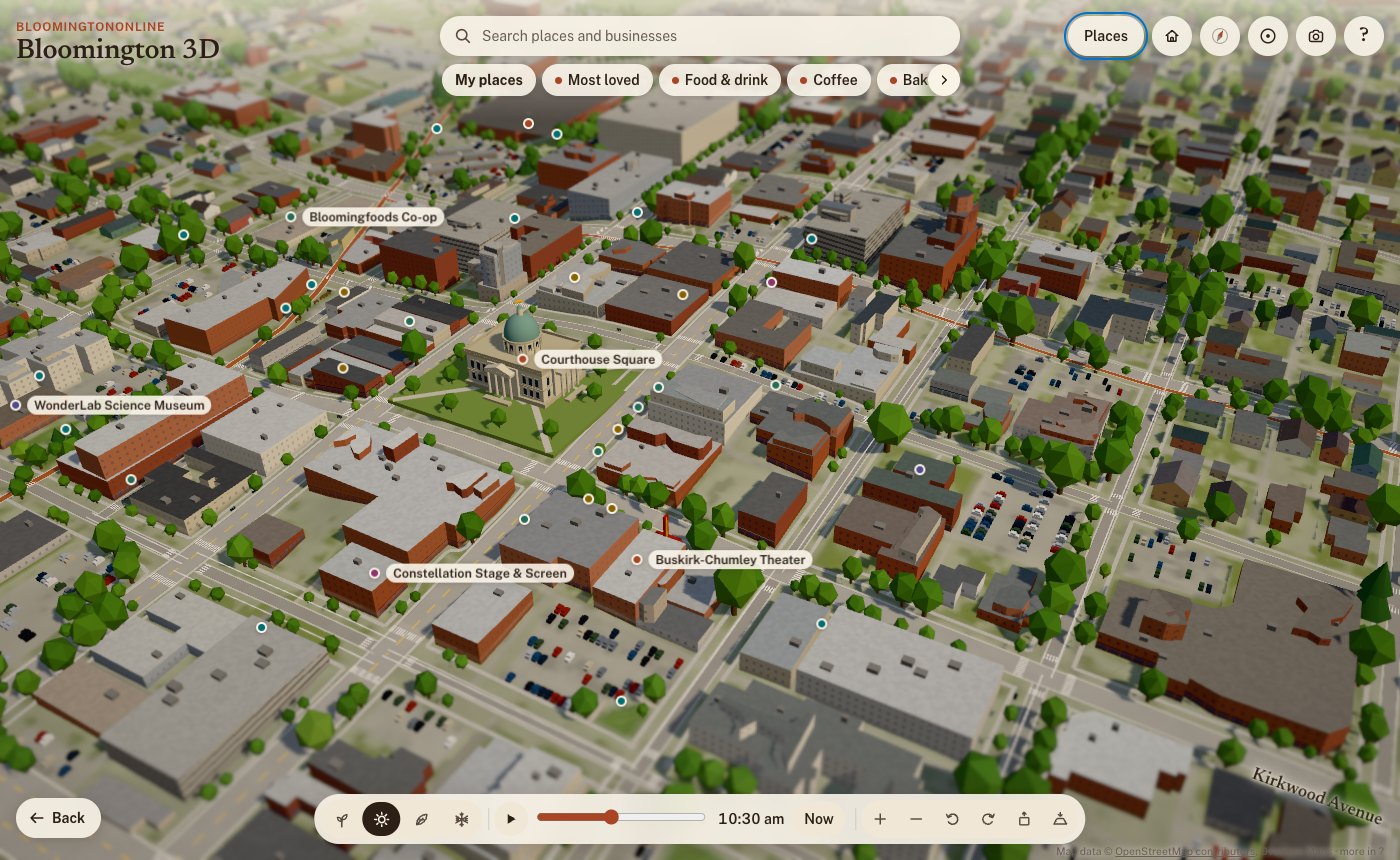
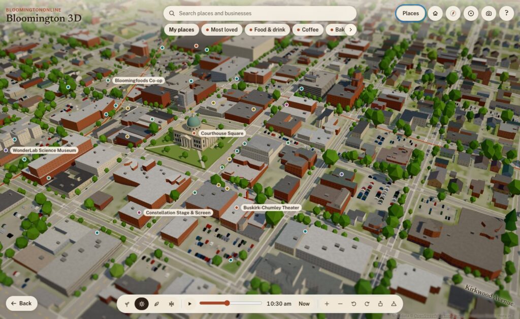
Downtown on a summer morning. Building heights and roof shapes are measured from lidar; roof colors come from the 2025 aerial photos.
Roof colors: the 2025 aerial photos
Flying over a model where every roof is the same gray is boring, and it isn’t Bloomington. So for 11,518 roofs in the core, the model samples the real color from IndianaMap’s 2025 statewide aerial imagery: the red metal roofs, the white flat roofs on campus, the weathered shingles. The same photos also lighten the ground where there’s paving and green it where there’s grass. We use the photos as data, not as a texture, so everything stays in the model’s diorama style.
36,000 real trees, and fall colors by species
The City of Bloomington keeps an inventory of its street and park trees, and IU surveyed its campus trees in 2019. Together that’s about 36,000 trees on the board, each standing where it really stands, and each with its species. So in fall:
red maples, sweetgums and red oaks turn red
sugar maples turn orange
tulip trees, ginkgos, honeylocusts and redbuds turn yellow
white oaks, beeches and sycamores go bronze
pines, spruces and cedars stay green
In spring, the redbuds and crabapples bloom pink and the dogwoods and pears bloom white. Dunn’s Woods and the campus look different from the near west side because they’re planted differently, and the model knows it. Beyond the inventories, trees follow the lidar canopy in the core and the landcover everywhere else.
The Old Crescent and Dunn's Woods in fall. Campus trees come from IU's tree inventory and change color by species.
The city’s own maps
From the City of Bloomington’s open data we use:
Historic districts and neighborhood boundaries: outlines like Prospect Hill and Elm Heights are the city’s own.
The bikeways layer.
The historic buildings survey: houses it rates as historic get an older-house look in Elm Heights and Prospect Hill.
The public art inventory: 42 outdoor works, each with the city’s photo, artist, year and medium. A “Public art” walk visits them in order, starting at the Square.
And BloomingtonOnline itself
Our own content is on the map too:
Things to Do guide: 67 places, linked both ways.
Neighborhoods guide: the north, east, south and west sides of town.
The business directory: more on that below.
Light, time and the seasons
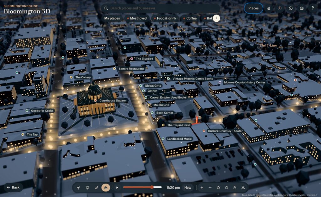
By default the model runs on live Bloomington time. The sun is where the real sun is, calculated for our latitude down to the minute, daylight saving time included. Watch it long enough and the shadows swing across the Square, the sky warms at golden hour, the street lamps come on, and the windows downtown light up after dark.
Live mode also follows the calendar, and the four season buttons let you jump ahead:
Spring: the redbuds and dogwoods bloom.
Summer: sailboats on Lake Monroe, paddlers on Griffy, and fireflies at dusk.
Fall: the species colors, with leaves drifting down.
Winter: snow on the roofs, wet streets and moonlit fields.
Some details only show up at the right moment. The farmers’ market tents are on Showers Common on Saturday mornings from April through October. From the Friday after Thanksgiving through December, the Canopy of Lights glows over the Square at night.
The Canopy of Lights over the Square, shown from the Friday after Thanksgiving through December.
You can also link to a moment. Adding ?season=winter&time=18:30#square to the address opens on the Canopy of Lights at dusk, which is handy for stories.
Hand-built landmarks
Data gets you most of the way. A few places deserved to be modeled by hand:
The courthouse: its dome and windowed drum, the copper fish weathervane, and window rows that light up at night.
Campus: the Sample Gates, the Rose Well House, Kirkwood Observatory’s dome, Showalter Fountain, the IU Auditorium’s front and the field at Memorial Stadium.
Downtown: the Buskirk-Chumley’s marquee and the sawtooth roof of the old Showers plant, now City Hall.
The Little 500 track.
Grout piles: heaps of waste limestone blocks along the rims of the quarries.
Older brick blocks within a few minutes’ walk of the Square get storefronts, awnings, arched upper windows and limestone cornices.
Ways to explore
A first look: a guided tour of the highlights.
Fly-alongs: rides along the B-Line, Kirkwood and out to Clear Creek. Nine more stay low: on foot down Fourth Street, College Avenue, Walnut, Third Street and 10th Street through campus, and by bike along the 7-Line, Cascades, Jackson Creek and the Karst Farm Greenway. The low routes were checked against the lidar so the camera clears every roof and treetop.
Low view: drops you to about 10 meters, looking down the street toward the horizon. Smaller places link to Google Street View when you want the real photos.
Circling: pick a place and the view slowly circles it, like Google Earth after a search.
Home, Back and the compass: Home takes you back to the Square, Back to your last view, and the compass to north, then straight down.
Save a picture: the camera button saves the current view as an image, credit included.
The business directory, on the map
This is where the model stops being a pretty picture and becomes part of BloomingtonOnline:
Every business on its building. More than 1,900 directory listings now have a See it on the 3D map button. The model places each one on its actual building, matched by name and address against OpenStreetMap and Overture, instead of rough estimates from street address ranges. Businesses just past the edge of the board get a pin on the rim pointing their way.
Categories as layers. The chips under the search box show one kind of business at a time: Food & drink, Coffee, Bakeries, Bars & nightlife, Pizza, Shops, Arts & entertainment, and Fitness & recreation. More has every directory category. Category pages in the directory link to their view on the map, so coffee is one tap away.
Search the whole directory. Type a name and any business on the board comes up.
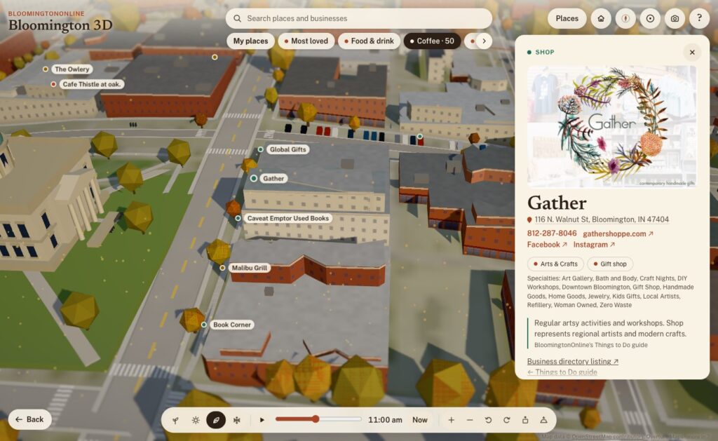
Rich business cards. Each card has the business’s photo, its categories and specialties, the address (linked to Google Maps), tap-to-call phone, website and social links. A Flag this listing link reaches our correction form.
My places. Tap Save on any place or business, here or on its directory page, and it goes into your own list on the map. You can share the whole list with a link.
Locals love this. A heart on every business. Votes add up, and Most loved shows the favorites on the map.
With the Coffee layer on, every coffee shop is a pin. Gather's card shows its photo, address, phone, website, social links and categories, live from the directory.
Putting the directory on a map also showed us where the directory needed work. Over the years, several bulk imports had added some businesses two or three times. So we built a review page, went through every suspected duplicate, and merged 194 duplicate listings into the right ones. Nothing was lost: phone numbers, photos, categories and tags were combined, and every old address now redirects to the listing that stayed. The directory now warns us when a new listing looks like one we already have.
How it was built
I built Bloomington 3D with Claude Code, Anthropic’s AI coding agent, working as a two-person team: I set the direction, judged the results and knew the town, and Claude wrote the code, chased down the data and tested everything before it went live. Every feature went through the same loop:
Ask. I’d describe what I wanted in plain words: “add Third Street too”, “the category selectors are being cut off”, “let’s make a camera icon for saving the view”.
Build. Claude found the right data or wrote the code, often several pieces at once.
Test. Every change was checked in a real browser, on desktop and phone sizes, before it shipped. That included flying the camera down the new fly-alongs and clicking through the new buttons.
Ship. A one-command deploy publishes the new version to the site, keeping the old one for an instant rollback, and every change is saved in version control. As of this writing there are 146 of them.
A few principles held the whole way through:
Facts first. Every claim on a place card traces back to a source on a fact sheet, and the copy was fact-checked twice. If something couldn’t be verified, it stayed out. That’s why the cards don’t say why the courthouse has a fish: nobody knows for sure.
Open data, credited. Every source is credited on the map. There’s no paid mapping service, no API key, and no recurring cost.
Private by default. Update, Oct 14: the map now uses anonymous Google Analytics to count what people tap, search for and share, so we can fix what is confusing. It collects no names or email addresses, and your saved places still stay on your own device. Tapping the heart on a business also runs a quick background check from Cloudflare (the same one our contact form uses). Your saved places stay on your own device.
Works on a phone. The model picks a lighter quality level on phones, runs slower when nothing’s moving to save battery, and offers lighter graphics if things get choppy. It scores 100 for accessibility on Google’s Lighthouse test.
Two days, start to now
Day one (Sunday).
Early afternoon: the first version, OpenStreetMap streets and buildings on terrain, with a tilt-shift look that makes it feel like a miniature.
Next two hours: three art-direction passes, then night lighting, seasons, the guided tour, landmarks, boats, storefronts and performance tuning for phones.
About 3 p.m.: it went live on the site.
Next hour: the lidar heights, roof colors, real trees, city outlines, public art and the first directory integration.
Evening: the Things to Do guide, the low fly-alongs, circling, directory pins on their buildings and category layers. It also got its name. It had started life as “Bloomington in miniature”, which I didn’t love.
Finding things: the search bar with category chips, and friendlier controls (Home, Back, double-tap to zoom, first-visit tips).
Links and history: working browser Back and Forward, and shareable links that stay tidy.
Directory features: richer business cards, My places, Locals love this, and pins for businesses just past the edge.
Directory cleanup: the duplicate merge.
A lot of the best changes came from simply using it. On day one I noticed the business pins weren’t quite on their buildings. The directory’s locations were estimates from street address ranges, often 20 to 100 meters off, so we matched every listing to its actual building instead. Coming in from a directory listing, I noticed the address bar kept the old business’s name. The browser’s Back button didn’t walk back through places. The category chips were cut off on a phone. Each of those took minutes to fix once I’d noticed it.
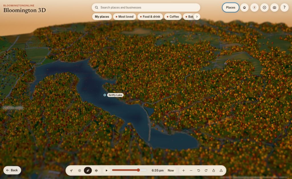
Griffy Lake at sunset in fall.
Where it goes from here
After two days, Bloomington 3D includes:
about 35,000 buildings and 36,000 real trees
50 written-up places, 67 Things to Do and 42 works of public art
a dozen fly-alongs
more than 1,900 businesses
four seasons and a sun that keeps real time
It’s also a living thing, and that’s the exciting part. A few ideas on the list:
a “show where I am” button
events on the map
live weather
more guided tours drawn from our guides
your saved places following you from device to device
But the best next steps will come from you. Take it for a spin, find your street, and save your favorite spots. Then tell us what you’d like to see, what’s missing, or what we got wrong. If a business is on the wrong building or out of date, use Flag this listing on its card. We read every one.
In the heart of Bloomington, Indiana, amidst the fervor of the Little 500, one man stands as a pillar of support and guidance: Greg Souder. For the past seven years, Greg has been the sole mechanic ensuring that every rider’s bike is race-ready, embodying the spirit of dedication and community that defines this iconic event.
A Serendipitous Beginning
Greg’s journey with the Little 500 began unexpectedly. After moving to Bloomington from Markle in 2017, he stumbled upon a classified ad his wife found, seeking a bike mechanic for the race. Despite initial doubts about his age being a barrier, Greg’s mechanical prowess and passion secured him the role. Since then, he’s become an integral part of the race’s fabric, mentoring countless students and ensuring the smooth operation of every bicycle on the track.
Greg Souder’s mechanic station awaits riders during Little 500 practice.A playful mascot adds some charm to the serious business of bike racing.Greg Souder’s toolkit—a key part of Little 500 tradition.Greg Souder shares his mechanical expertise with student cyclists.
Mentorship Beyond Mechanics
Beyond fixing bikes, Greg serves as a mentor and confidant to the student riders. He recalls with pride how freshmen, initially unfamiliar with basic bike maintenance, evolve into team captains by their senior year, often imparting knowledge to newcomers. His approachable nature and willingness to teach have made him a beloved figure among the riders. IDS News
Facing Challenges with Resilience
In 2021, Greg faced a personal health challenge with a cancer diagnosis. The support from the Little 500 community was overwhelming, with students and staff rallying around him during his treatment. This outpouring of care reaffirmed his deep connection to the event and its participants. Remarkably, just two months after surgery, Greg was back at the track, embodying resilience and dedication.IDS News
A Lasting Legacy
As Greg continues his tenure, he hopes to reach a decade of service, dreaming that the bike shop might one day bear his name. His story is a testament to the profound impact one individual can have on a community, turning a simple role into a legacy of mentorship, resilience, and unwavering commitment.
Precision and care: Greg Souder ensures every bike is race-ready.
For a more in-depth look into Greg’s journey and contributions, you can read the full feature here: IDS News.
We use cookies to see which pages are useful (Google Analytics, Microsoft Clarity). No ads, and nothing is sold. Privacy policy