Yesterday we told you how Bloomington 3D came together in two days. Today was about everything behind it: the business directory. We rewrote hundreds of listings from sourced facts, rebuilt the category system so businesses are where you would look for them, added a way to see what is popular, and tuned the map so it follows the new categories. Here is what changed and why.
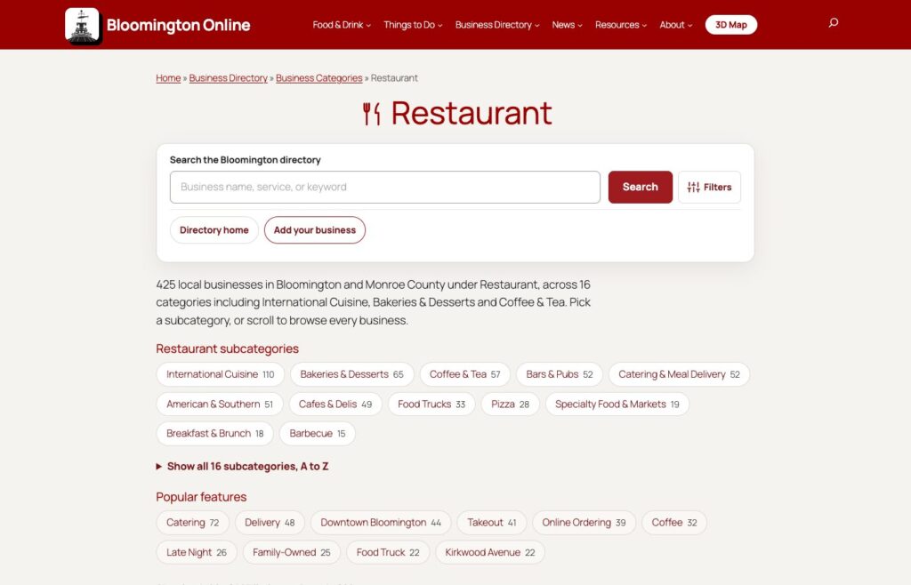
The Restaurant page now has 16 clear groups, with a count of businesses in each.
Why we started with the directory
Bloomington 3D shows every business in our directory on its building. That made the weak spots obvious. Many listings had a one-line description copied from an import. Some businesses had closed. Some websites had been taken over by spam. And the same restaurant could sit in four overlapping categories, so you could not tell where to look for pizza, or sushi, or a coffee shop that also bakes.
So today we did a cleanup, in four parts.
1. Food listings, rewritten from sources
The food and drink listings came first. For each of the 480 listings, we researched the business from its own website, its social pages, local news and guides. Then we wrote a new short description and a fuller write-up, fixed the categories, and added photos and logos where we could find them.
One rule made this safe: every fact in a description had to come with a source link and the exact words from that page, and a script then re-opened each page to confirm the words were really there. A sentence that could not be confirmed stayed out. If a business could not be confirmed as open, we did not rewrite it.
The result: more than 250 listings were rewritten and are live. The ones we could not verify were held back and reviewed one by one. About fifty listings that were closed, duplicated or not really in Bloomington were removed or merged, and every old web address for a merged listing now sends you to the one that is left. We also cleared the website link on a handful of listings where the old site had been taken over by an unrelated spam or gambling page.
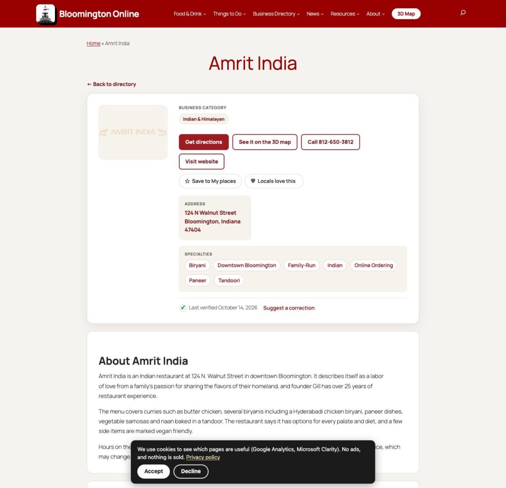
A rewritten listing: cuisine category, directions, the 3D map, specialties as tags, and the date it was last verified.
2. Categories that make sense
Under Restaurant there were 48 overlapping subcategories. We looked at how Visit Bloomington groups dining, how Yelp splits food from nightlife, and how our own listings had been tagged by several imports over the years. Then we reorganized: 16 groups, including American & Southern, Barbecue, Pizza, Breakfast & Brunch, Bakeries & Desserts, Coffee & Tea, Bars & Pubs, Breweries, Food Trucks, and one International Cuisine group that holds eight cuisines from Mexican and Latin American to Japanese & sushi.
Then we did the same for everything else. The non-food categories went from about 313 to about 145, grouped under nine sections. The big catch-all, Professional Services, held 275 listings from a single import, with banks, law firms, insurance agents and car dealers all mixed together. They now sit in their own categories. More than 700 listings moved to a better home, and the number of listings with no category at all dropped from 141 to 26.
Tags got the same treatment. There were about 2,500, and most were used once, or just repeated the category name. We cut them to about 1,400 and fixed the capitalization.
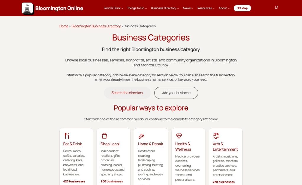
The categories page lists every category by section, with live counts.
3. Category pages that help you choose
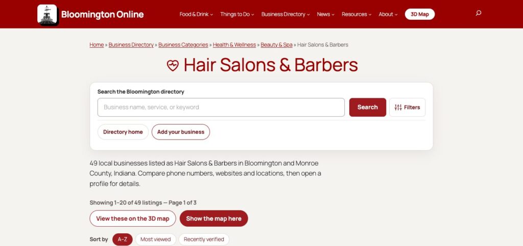
The category pages got a redesign too. Each now opens with a plain sentence about what is in it, subcategory chips, related categories and popular features such as Takeout, Online Ordering or Family-Owned. You can sort by A to Z, most viewed or recently verified, and long lists scroll without page buttons. A button on every category opens just those businesses on the 3D map.
A category page with search, a count of businesses, sorting, and buttons for the 3D map.
4. What people love, and what is new
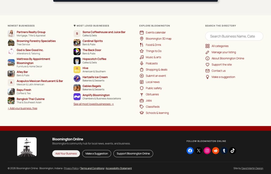
The footer now shows Most Loved Businesses and the newest businesses side by side, each with a photo or logo and its category, so a visit can start with what other people like. Listing cards also show a small visits count once a business has been looked at enough times for the number to mean something. Business owners get a traffic panel on their own listing that nobody else sees.
The new footer: newest businesses, most loved businesses, and links to explore Bloomington.
5. The map follows the new categories
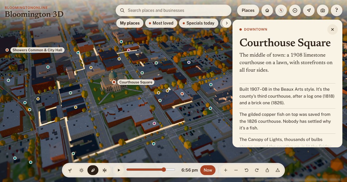
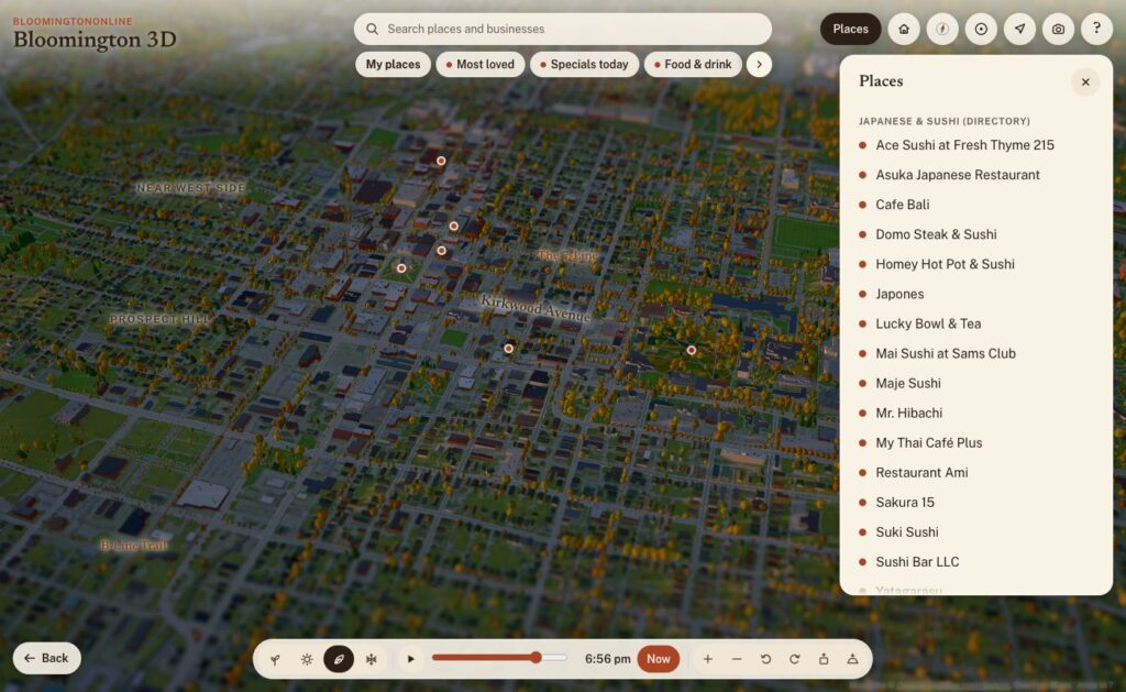
The 3D map groups its businesses by category, so we updated it to match. The chips along the top, such as Bars & pubs, Japanese & sushi, Bakeries & desserts, Coffee, Pizza, Breweries and Food trucks, now follow the reorganized food categories. Tap one and the pins and a list appear. The search box also finds businesses by tag and category and shows the short description on each card.
A few other things landed on the map today:
A Show where I am button, so you can find yourself in town. It uses your location only on your own device while you press it.
Specials today: daily food and drink specials from a calendar we keep of Bloomington bars and restaurants.
An Edible trees layer, built from the City and IU tree inventories after a reader pointed us to a community map of fruit and nut trees.
Most loved lists, and hearts and stars on directory cards. Votes are checked by Cloudflare Turnstile so one person cannot pile on, but it stays easy to love your favorites.
Tap a category chip and the matching businesses appear on the map and in a list.
6. Behind the scenes
Some of the work does not show on the page, but it is what makes the site findable.
Search engines now get specific labels. A dentist is marked as a dentist and a hotel as a hotel, and the directory keeps those labels working after the category renames.
Old addresses are redirected. Merged categories and tags, retired listings and old pages now send you to the closest live page instead of a dead end.
Pages are faster. Google’s Lighthouse test scores the home page 98 for performance on a phone, up from the 70s and 80s, and 95 to 97 for accessibility.
The new compact header puts a 3D Map button in the main menu.
We also added anonymous usage statistics to the map today, and this changes something we said yesterday. Bloomington 3D now uses Google Analytics to count what people tap, search for and share, so we can fix what is confusing and build what people use. It does not collect names or email addresses, and your saved places still stay on your own device. Our privacy policy explains how analytics are used.
The statistics already taught us something: about half of last month’s page views on the site were not people. They were automated bots, mostly in two short spikes in September. Knowing that makes every other number more honest.
How it was made
Like yesterday, this was a collaboration with AI. Several Claude Code agents worked side by side: one researching businesses, one reorganizing categories, one on the page design, one on analytics and redirects. Every change was saved with a backup first so that anything could be undone, and a person made the calls on anything uncertain. We got some things wrong along the way. The first time we nested the old categories under the ten top-level sections, we filed Aviation under Fitness. A day of looking at the live pages caught it, and it is fixed.
What is next
Researching the listings we could not verify yet, and finishing the last unclassified restaurants.
A short email digest of what is new and what is happening in town.
A way for business owners to claim and complete their own listing.
More of the 3D map: events, live weather and more guided tours.
Take a look around. Browse the new categories, open the map, and love a few favorites. If something is out of date or in the wrong place, use Flag this listing on any business card, or tell us. We read every one.
Two days ago there was no 3D Bloomington. Now there’s one you can fly around, from the copper fish on the courthouse to the sailboats on Lake Monroe. It’s built from real survey data, it lights up at dusk, it changes with the seasons, and every business in our directory can show up on it. Here’s what we built, where the data came from, and how it came together.
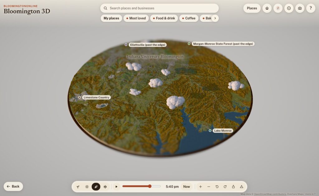
The whole board: Bloomington and the hills around it, about 12 miles across, on a fall evening.
What it is
Bloomington 3D is a model of Bloomington and the country around it: a round board about 19 kilometers (12 miles) across, centered just south of downtown, sitting on a walnut plinth like a museum diorama. The cut edge shows layers of limestone, and where the board slices through Lake Monroe you can see the water in cross-section.
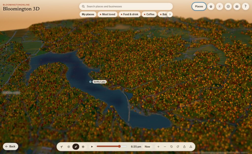
It runs in any modern browser, on a phone or a computer, with nothing to install. It opens on the Courthouse Square. Drag to move, pinch or scroll to zoom, and tap anything outlined, pinned or named to read about it. Each place has a card with a short, fact-checked write-up, nearby places to wander to next, and a link you can share. For example, bloomingtononline.com/town/#griffy opens straight onto Griffy Lake.
Where the town comes from
None of the geography is drawn by hand. Every street, building, tree and creek comes from public data, and the map credits each source on screen. Here’s what’s in it.
Streets, buildings and paths: OpenStreetMap
The base layer is OpenStreetMap, the volunteer-built map of the world. It supplies the roads, the B-Line and the other trails, the creeks, parks, rail lines and building footprints. It also has the small things you notice once you zoom in: about 2,900 sidewalk segments and 4,300 other footpaths, crosswalks, bike lanes, benches, bike racks, picnic tables and parking lots, which fill up with little parked cars.
The hills: USGS elevation data
Southern Indiana isn’t flat, and the model shouldn’t be either. The terrain comes from USGS elevation data via open terrain tiles, with the hills exaggerated about two times so the ridges and hollows read at a glance, the way a museum diorama does. Buildings and trees stand at their real heights. Where OpenStreetMap doesn’t map the woods, the model fills undeveloped slopes with forest, because that’s what our hollows are.
Real building heights: 154 million laser points
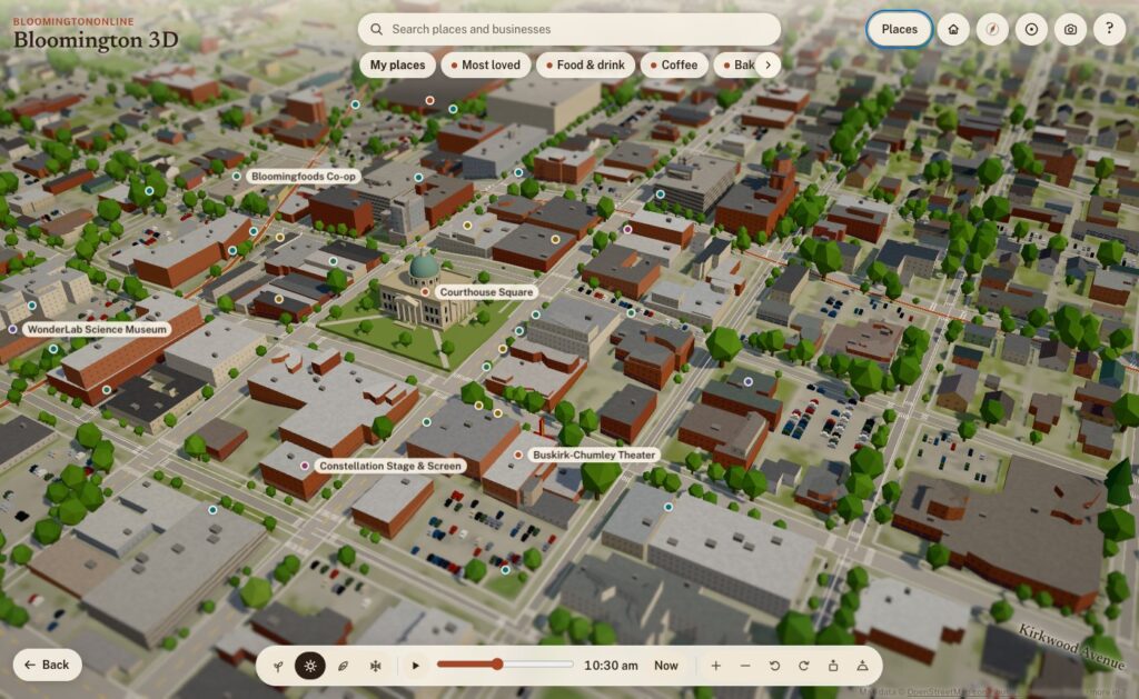
This is the part I’m proudest of. Indiana was flown with lidar between 2017 and 2019 for the USGS 3D Elevation Program: an airplane sweeps a laser across the ground and records where every pulse bounces back. We streamed the 21 tiles that cover downtown, campus, Prospect Hill, Elm Heights, Bryan Park and the near west side, which is 154.6 million points, and turned them into a one-meter grid of the town.
From that grid, the model measures:
the eave and ridge height of 11,565 buildings, so roofs are the right height and the right shape
stepped roofs on bigger buildings, traced in tiers every 3.5 meters, so a building with a tall section and a low wing looks like that
towers that rise above the rest of a building
the tree canopy, so the woods and big yard trees stand where they really are
the bare ground under it all, more detailed than the terrain everywhere else
Outside that core, building heights come from Microsoft’s machine-learning estimates, published through Overture Maps, which also fills in buildings OpenStreetMap doesn’t have yet. All told, there are about 35,000 buildings on the board.
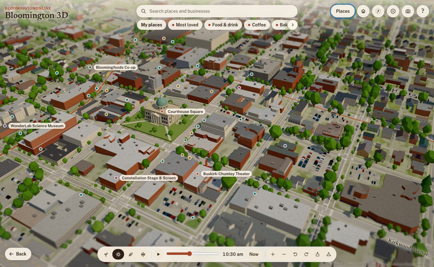
Downtown on a summer morning. Building heights and roof shapes are measured from lidar; roof colors come from the 2025 aerial photos.
Roof colors: the 2025 aerial photos
Flying over a model where every roof is the same gray is boring, and it isn’t Bloomington. So for 11,518 roofs in the core, the model samples the real color from IndianaMap’s 2025 statewide aerial imagery: the red metal roofs, the white flat roofs on campus, the weathered shingles. The same photos also lighten the ground where there’s paving and green it where there’s grass. We use the photos as data, not as a texture, so everything stays in the model’s diorama style.
36,000 real trees, and fall colors by species
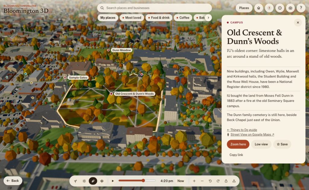
The City of Bloomington keeps an inventory of its street and park trees, and IU surveyed its campus trees in 2019. Together that’s about 36,000 trees on the board, each standing where it really stands, and each with its species. So in fall:
red maples, sweetgums and red oaks turn red
sugar maples turn orange
tulip trees, ginkgos, honeylocusts and redbuds turn yellow
white oaks, beeches and sycamores go bronze
pines, spruces and cedars stay green
In spring, the redbuds and crabapples bloom pink and the dogwoods and pears bloom white. Dunn’s Woods and the campus look different from the near west side because they’re planted differently, and the model knows it. Beyond the inventories, trees follow the lidar canopy in the core and the landcover everywhere else.
The Old Crescent and Dunn's Woods in fall. Campus trees come from IU's tree inventory and change color by species.
The city’s own maps
From the City of Bloomington’s open data we use:
Historic districts and neighborhood boundaries: outlines like Prospect Hill and Elm Heights are the city’s own.
The bikeways layer.
The historic buildings survey: houses it rates as historic get an older-house look in Elm Heights and Prospect Hill.
The public art inventory: 42 outdoor works, each with the city’s photo, artist, year and medium. A “Public art” walk visits them in order, starting at the Square.
And BloomingtonOnline itself
Our own content is on the map too:
Things to Do guide: 67 places, linked both ways.
Neighborhoods guide: the north, east, south and west sides of town.
The business directory: more on that below.
Light, time and the seasons
By default the model runs on live Bloomington time. The sun is where the real sun is, calculated for our latitude down to the minute, daylight saving time included. Watch it long enough and the shadows swing across the Square, the sky warms at golden hour, the street lamps come on, and the windows downtown light up after dark.
Live mode also follows the calendar, and the four season buttons let you jump ahead:
Spring: the redbuds and dogwoods bloom.
Summer: sailboats on Lake Monroe, paddlers on Griffy, and fireflies at dusk.
Fall: the species colors, with leaves drifting down.
Winter: snow on the roofs, wet streets and moonlit fields.
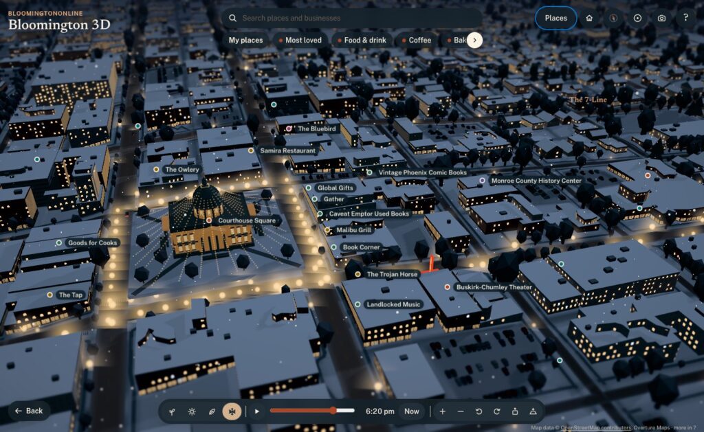
Some details only show up at the right moment. The farmers’ market tents are on Showers Common on Saturday mornings from April through October. From the Friday after Thanksgiving through December, the Canopy of Lights glows over the Square at night.
The Canopy of Lights over the Square, shown from the Friday after Thanksgiving through December.
You can also link to a moment. Adding ?season=winter&time=18:30#square to the address opens on the Canopy of Lights at dusk, which is handy for stories.
Hand-built landmarks
Data gets you most of the way. A few places deserved to be modeled by hand:
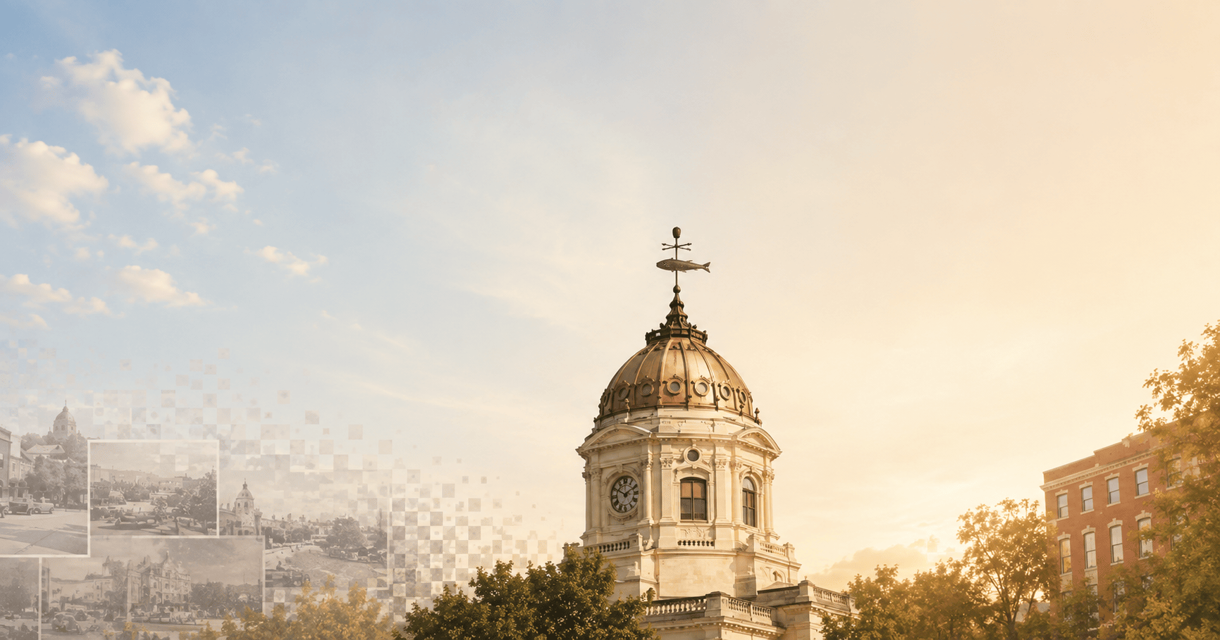
The courthouse: its dome and windowed drum, the copper fish weathervane, and window rows that light up at night.
Campus: the Sample Gates, the Rose Well House, Kirkwood Observatory’s dome, Showalter Fountain, the IU Auditorium’s front and the field at Memorial Stadium.
Downtown: the Buskirk-Chumley’s marquee and the sawtooth roof of the old Showers plant, now City Hall.
The Little 500 track.
Grout piles: heaps of waste limestone blocks along the rims of the quarries.
Older brick blocks within a few minutes’ walk of the Square get storefronts, awnings, arched upper windows and limestone cornices.
Ways to explore
A first look: a guided tour of the highlights.
Fly-alongs: rides along the B-Line, Kirkwood and out to Clear Creek. Nine more stay low: on foot down Fourth Street, College Avenue, Walnut, Third Street and 10th Street through campus, and by bike along the 7-Line, Cascades, Jackson Creek and the Karst Farm Greenway. The low routes were checked against the lidar so the camera clears every roof and treetop.
Low view: drops you to about 10 meters, looking down the street toward the horizon. Smaller places link to Google Street View when you want the real photos.
Circling: pick a place and the view slowly circles it, like Google Earth after a search.
Home, Back and the compass: Home takes you back to the Square, Back to your last view, and the compass to north, then straight down.
Save a picture: the camera button saves the current view as an image, credit included.
The business directory, on the map
This is where the model stops being a pretty picture and becomes part of BloomingtonOnline:
Every business on its building. More than 1,900 directory listings now have a See it on the 3D map button. The model places each one on its actual building, matched by name and address against OpenStreetMap and Overture, instead of rough estimates from street address ranges. Businesses just past the edge of the board get a pin on the rim pointing their way.
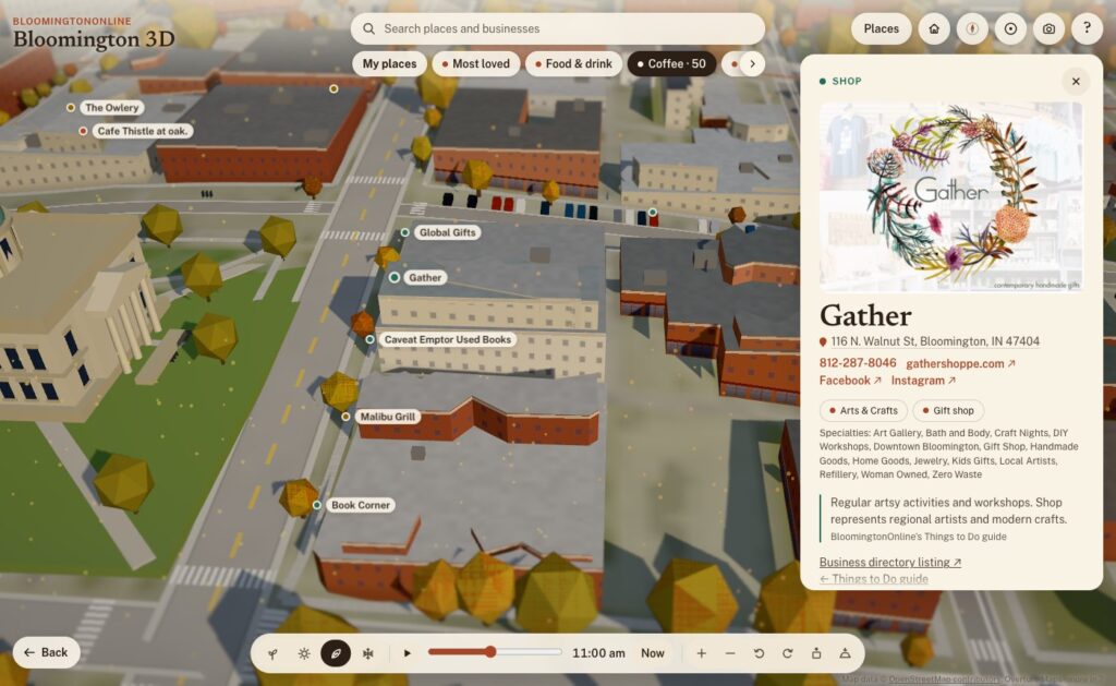
Categories as layers. The chips under the search box show one kind of business at a time: Food & drink, Coffee, Bakeries, Bars & nightlife, Pizza, Shops, Arts & entertainment, and Fitness & recreation. More has every directory category. Category pages in the directory link to their view on the map, so coffee is one tap away.
Search the whole directory. Type a name and any business on the board comes up.
Rich business cards. Each card has the business’s photo, its categories and specialties, the address (linked to Google Maps), tap-to-call phone, website and social links. A Flag this listing link reaches our correction form.
My places. Tap Save on any place or business, here or on its directory page, and it goes into your own list on the map. You can share the whole list with a link.
Locals love this. A heart on every business. Votes add up, and Most loved shows the favorites on the map.
With the Coffee layer on, every coffee shop is a pin. Gather's card shows its photo, address, phone, website, social links and categories, live from the directory.
Putting the directory on a map also showed us where the directory needed work. Over the years, several bulk imports had added some businesses two or three times. So we built a review page, went through every suspected duplicate, and merged 194 duplicate listings into the right ones. Nothing was lost: phone numbers, photos, categories and tags were combined, and every old address now redirects to the listing that stayed. The directory now warns us when a new listing looks like one we already have.
How it was built
I built Bloomington 3D with Claude Code, Anthropic’s AI coding agent, working as a two-person team: I set the direction, judged the results and knew the town, and Claude wrote the code, chased down the data and tested everything before it went live. Every feature went through the same loop:
Ask. I’d describe what I wanted in plain words: “add Third Street too”, “the category selectors are being cut off”, “let’s make a camera icon for saving the view”.
Build. Claude found the right data or wrote the code, often several pieces at once.
Test. Every change was checked in a real browser, on desktop and phone sizes, before it shipped. That included flying the camera down the new fly-alongs and clicking through the new buttons.
Ship. A one-command deploy publishes the new version to the site, keeping the old one for an instant rollback, and every change is saved in version control. As of this writing there are 146 of them.
A few principles held the whole way through:
Facts first. Every claim on a place card traces back to a source on a fact sheet, and the copy was fact-checked twice. If something couldn’t be verified, it stayed out. That’s why the cards don’t say why the courthouse has a fish: nobody knows for sure.
Open data, credited. Every source is credited on the map. There’s no paid mapping service, no API key, and no recurring cost.
Private by default. Update, Oct 14: the map now uses anonymous Google Analytics to count what people tap, search for and share, so we can fix what is confusing. It collects no names or email addresses, and your saved places still stay on your own device. Tapping the heart on a business also runs a quick background check from Cloudflare (the same one our contact form uses). Your saved places stay on your own device.
Works on a phone. The model picks a lighter quality level on phones, runs slower when nothing’s moving to save battery, and offers lighter graphics if things get choppy. It scores 100 for accessibility on Google’s Lighthouse test.
Two days, start to now
Day one (Sunday).
Early afternoon: the first version, OpenStreetMap streets and buildings on terrain, with a tilt-shift look that makes it feel like a miniature.
Next two hours: three art-direction passes, then night lighting, seasons, the guided tour, landmarks, boats, storefronts and performance tuning for phones.
About 3 p.m.: it went live on the site.
Next hour: the lidar heights, roof colors, real trees, city outlines, public art and the first directory integration.
Evening: the Things to Do guide, the low fly-alongs, circling, directory pins on their buildings and category layers. It also got its name. It had started life as “Bloomington in miniature”, which I didn’t love.
Finding things: the search bar with category chips, and friendlier controls (Home, Back, double-tap to zoom, first-visit tips).
Links and history: working browser Back and Forward, and shareable links that stay tidy.
Directory features: richer business cards, My places, Locals love this, and pins for businesses just past the edge.
Directory cleanup: the duplicate merge.
A lot of the best changes came from simply using it. On day one I noticed the business pins weren’t quite on their buildings. The directory’s locations were estimates from street address ranges, often 20 to 100 meters off, so we matched every listing to its actual building instead. Coming in from a directory listing, I noticed the address bar kept the old business’s name. The browser’s Back button didn’t walk back through places. The category chips were cut off on a phone. Each of those took minutes to fix once I’d noticed it.
Griffy Lake at sunset in fall.
Where it goes from here
After two days, Bloomington 3D includes:
about 35,000 buildings and 36,000 real trees
50 written-up places, 67 Things to Do and 42 works of public art
a dozen fly-alongs
more than 1,900 businesses
four seasons and a sun that keeps real time
It’s also a living thing, and that’s the exciting part. A few ideas on the list:
a “show where I am” button
events on the map
live weather
more guided tours drawn from our guides
your saved places following you from device to device
But the best next steps will come from you. Take it for a spin, find your street, and save your favorite spots. Then tell us what you’d like to see, what’s missing, or what we got wrong. If a business is on the wrong building or out of date, use Flag this listing on its card. We read every one.
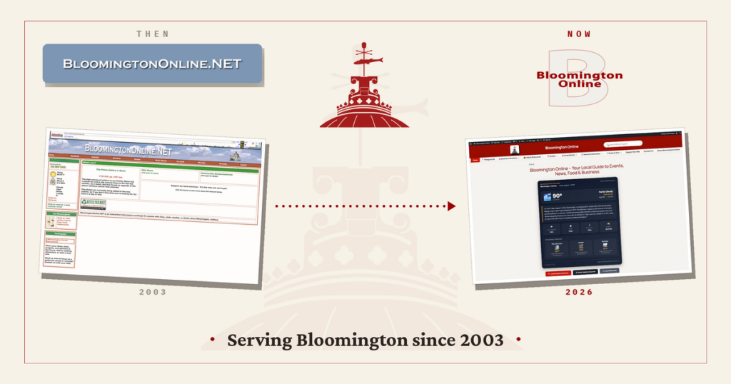
Bloomington Online has been a quiet fixture of local life for more than twenty years. Lately it has been growing again, so this feels like a good moment to look back at how it started, share what we have been building, and talk about where we hope to take it. If you want the fuller story, our new About page covers it too.
Where it started
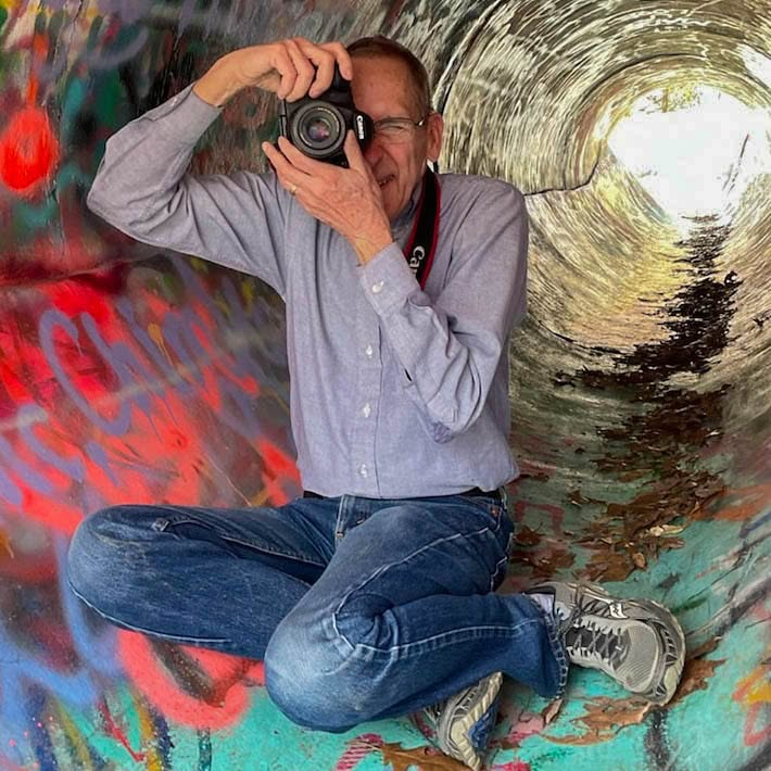
Bloomington Online has been part of the local web since 2003. For much of that time it was the work of one person, Dale Staton, who built it by hand into something impressive and technically complex.
Dale Staton built Bloomington Online and spent years documenting Bloomington through his camera.
Dale put himself into the site the way he put himself into everything he cared about: photography, staying close to people, and showing up at community events all over town. When the time came to pass it on, we met at a local Starbucks and he walked through everything he had made. It was remarkable, and we were glad to help keep it alive and growing.
Where we are today
Over the past year we rebuilt Bloomington Online on a modern platform and added a lot to it. A few of the pieces you can explore right now:
Practical resources like local jobs, obituaries, and public safety information.
The goal behind all of it is simple. Give residents a reliable home base for local life, and give local organizations a place to be found.
Update, October 2026: we’ve added Bloomington 3D, an explorable 3D model of the town with every business in the directory on its building. Read how we built it.
What we hope to accomplish
We want Bloomington Online to keep getting more useful, and more local, over time. Some of what we are working toward:
Growing the directory so more of Bloomington’s businesses and nonprofits are represented.
Keeping local news and events current and easy to scan.
Adding more community photos, stories, and resources.
Welcoming neighbors who want to help, whether that is sharing an event, suggesting a listing, or lending a hand.
We would also love your input on what would make the site more valuable to you. You can always make a suggestion.
A community effort
Bloomington Online is community supported. It is not a nonprofit, so contributions are not tax deductible, but they are what keep it running: hosting, upkeep, and the news aggregation that keeps headlines flowing. If the site is useful to you, you can help keep it going on our support page.
More than anything, this is a thank you. To Dale, for building something worth carrying forward. And to everyone in Bloomington who uses the site, adds to it, and helps it grow.
We use cookies to see which pages are useful (Google Analytics, Microsoft Clarity). No ads, and nothing is sold. Privacy policy