
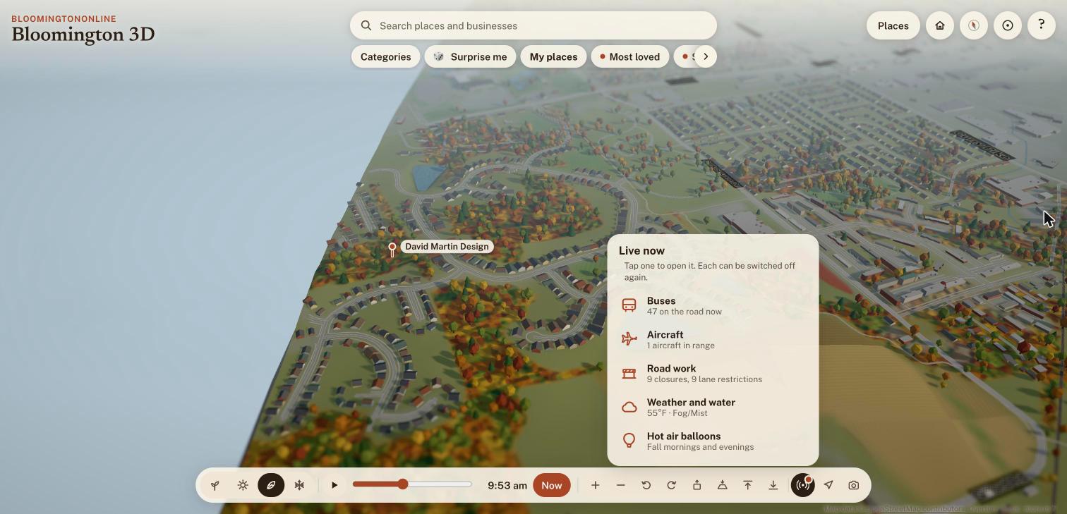
Since the October 19 post, working with Claude Code, we have changed a lot of Bloomington Online. There is a new menu on every page. Restaurants have menu buttons and an "Open now" filter. The 3D map shows live buses, planes, weather and road work. Neighbors can share photos, and there is a free local marketplace. We also built more of Bloomington in 3D, from the Waldron Arts Center to Ivy Tech. This post is the long version, with screenshots from the live site, starting with the things most visitors will notice.
The short version
- A new header menu on every page, with a phone menu that folds away
- Menu buttons on 185 restaurants, bakeries, coffee shops and food trucks, plus filters for Open now, Has a menu, Order online and Vegan options
- A smoother 3D map: no more startup freezes, cards you can drag on a phone, a Surprise me button and a What's new card
- Live buses, aircraft, weather and water levels, and City road work on the map
- Bloomington in photos, where neighbors share pictures of town
- A redesigned news page, a safer weekly email and a free local marketplace
- New 3D buildings: John Waldron Arts Center, WFHB's firehouse, Ivy Tech, Bloom Magazine, La Charreada and more of the Trades District
A simpler menu on every page
The old header menu had about 50 links, and on a phone it opened into a panel more than 2,400 pixels tall. Nobody was going to read all of that. The new menu has six groups: Eat & Drink, Things to Do, Directory, Marketplace, News & Resources and About, with a white 3D Map button beside them. It now has 36 links.
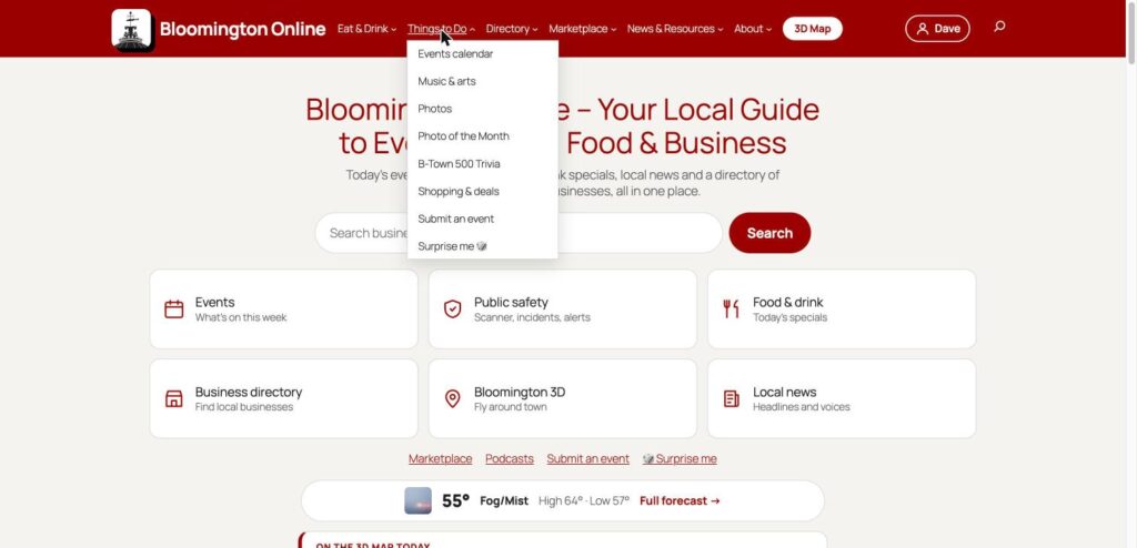
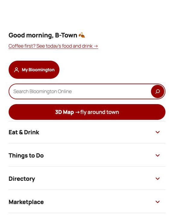
On a phone or a narrow window, each group folds open one at a time instead of spilling out as one long list. At the top you get a greeting that changes with the time of day, a search box and a big 3D Map button.
Surprise me, in the Things to Do group, sends you to a random food, shop, arts, stay or fitness listing that has a photo. It is a good way to find a place you did not know about. We also added a site map to the footer, a helpful 404 page for broken links, and a search tab that finds community photos.
The directory: menus, open now and vegan options
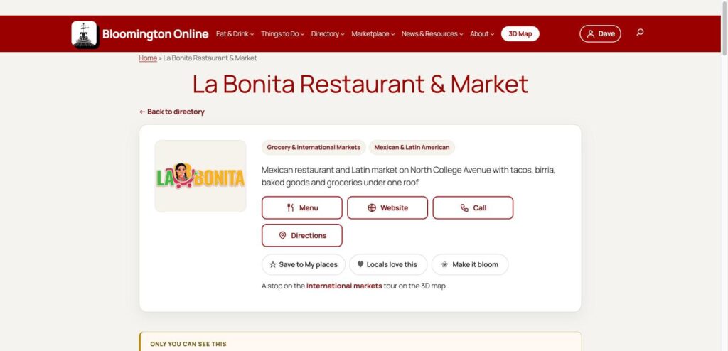
The directory is the heart of this site, so it got the most attention. The biggest change is menus. About 185 restaurants, bakeries, coffee shops and food trucks now have a Menu button, 349 menu links in all. Every link goes to the business's own menu, whether that is a page on its website, a PDF or its own online ordering page. We did not link to delivery apps, review sites or Facebook, and we did not copy menu text. A weekly check flags any menu link that stops working.
Category pages now have a Show only row. Open now lists places that are open at this moment, and each card says when it closes. Has a menu and Order online do what they say. About 209 listings have hours entered so far, so Open now gets more useful every time we add more.
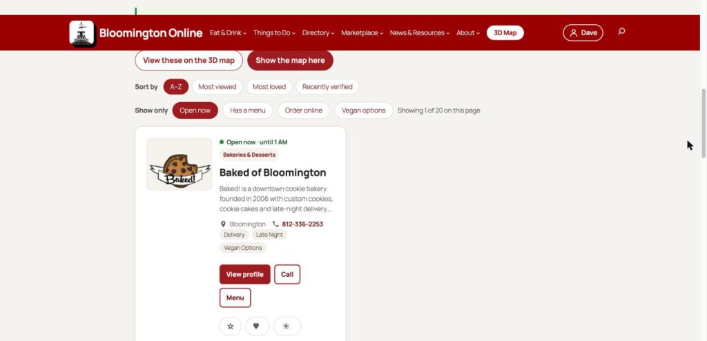
Vegan food got its own audit. We checked 91 businesses against their own menus. Three are tagged Vegan because the whole menu is vegan: Rainbow Bakery, Planted Bloomington and Natures Plate in Greencastle. Another 54 are tagged Vegan Options because the business itself says it has a vegan dish. The Vegan options filter on category pages uses those tags, and the tags also name what is vegan, such as vegan pizza or tofu dishes. Our vegan food guide and late-night food guide came out of the same work, and the map has a ten-stop vegan tour.
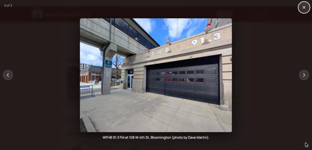
A few smaller things on listing pages. Photos open in a viewer with captions and credits, and logos now show whole instead of being cropped. There is a second reaction, Make it bloom, next to Locals love this. Business owners can use Own this business? Claim or update it to ask us for changes. A listing for a place on one of the map's tours now says so and links to the tour. WFHB, below, is a good example of the photo viewer.
We also rewrote and fact-checked dozens of listings from each business's own website, including markets, bars, Soma and its neighbors, and added Enrich Barbershop. Duplicates were merged, a few listings we could not verify were removed, and the news feeds on the WFHB, WFIU and Bloomington Community Band pages now show the right station or group. Our Featured Eats page was rebuilt as cards for the winners of our readers' survey.
The 3D map, for everyone
These changes reach everyone who opens the map. It no longer freezes for a few seconds while the town builds. On a phone, place cards now sit low and you can drag them up to read more, or pull down to close them. The zoom and tilt buttons moved into a stack along the edge, so your thumb can reach them. On a computer, hovering over a button shows what it does. In low, close-up views, trees that stand in your line of sight now thin out, so you can see the building you came to look at.
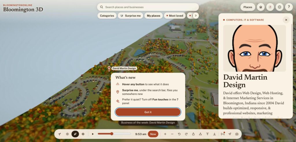
We added some play too. The Surprise me chip under the search bar flies you somewhere new. Returning visitors get a short greeting, and saving places can bring a bit of confetti. A Fun touches switch in the ? panel turns all of it off for people who prefer it quiet. A one-time What's new card tells returning visitors about the changes, and the ? help panel now scrolls and explains each button. When you share a place on the map, a friend who gets the link sees a preview of that place.
Live now: buses, aircraft, road work and weather
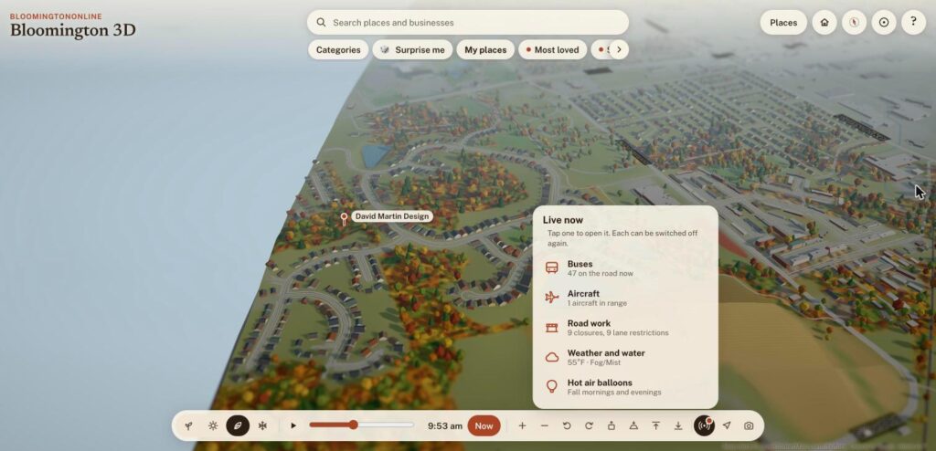
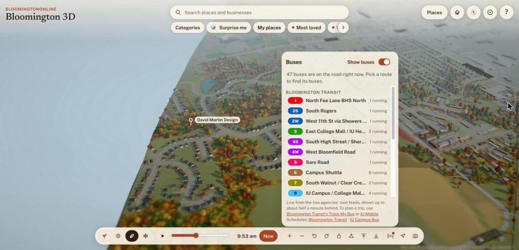
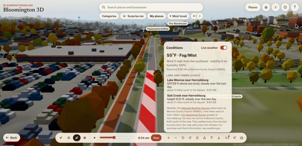
The new Live now button opens a menu of things that are happening right now. When we took these screenshots, it showed 47 buses on the road, one aircraft in range, 9 road closures and 9 lane restrictions, and 55 degrees with fog.
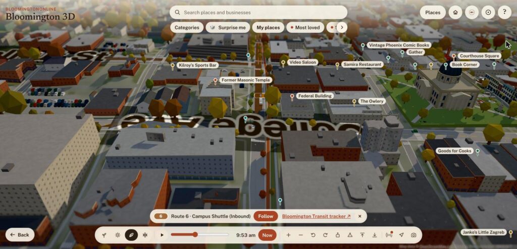
Buses show Bloomington Transit and IU Campus Bus vehicles from the two agencies' own live feeds, usually about half a minute behind. Pick a route in the list to see its line and buses, then tap a bus to follow it. For trip planning, the panel links to Bloomington Transit's Track My Bus and IU Mobile.
Aircraft are planes and helicopters near town, from adsb.lol, with the aircraft type when we know it. There are often only a few, because Bloomington's sky is not busy, and the positions update every few minutes.
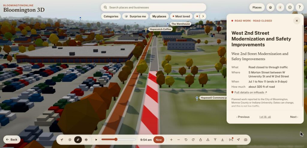
Road work comes from the City of Bloomington's inRoads list of planned work and long closures. Closures are drawn in red and white stripes on the street, and lane restrictions in orange. Tap one for a card with what, where, when and how much road is affected, then use Previous and Next to move through all of them. This is planned work, not live traffic or crashes.
Weather and water shows the current conditions from the National Weather Service station at the Monroe County Airport and the lake and creek levels from the U.S. Geological Survey. It is on by default, so the sky on the map looks like the sky outside, with fog, rain or snow when it is there. There is a switch to turn it off. Street names are now painted on the ground, from OpenStreetMap, and signs mark the signalized intersections.
Bloomington in photos
Bloomington Online now has a place for pictures of town, taken by the people who live here. The photos page lists the photos by category (architecture, events and festivals, parks and nature, seasons, skies and weather, wildlife), newest first or most loved. You can heart a photo or make it bloom, and photos can also be pinned on the 3D map. There is also a Photo of the Month.
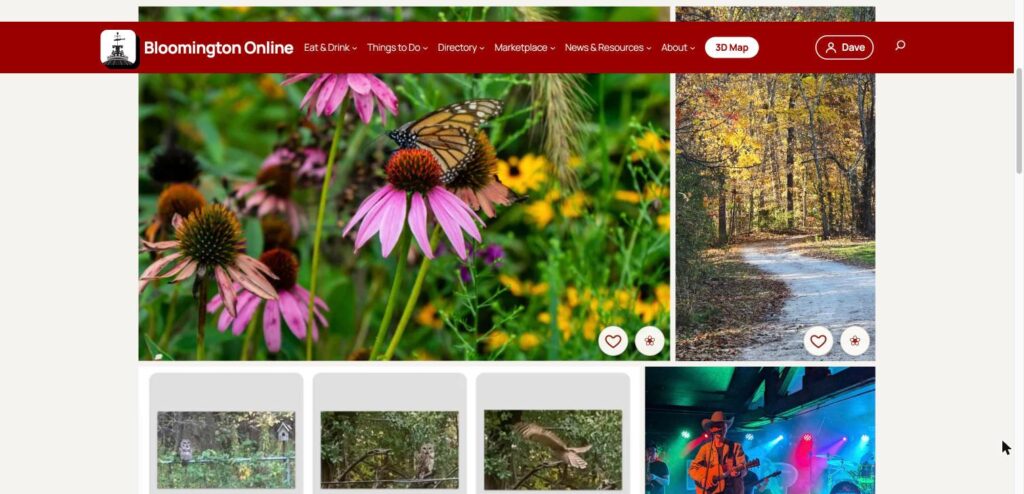
Share a photo takes your picture, a title and a category or two, and a person reviews every submission before it goes up. There are ten photos so far, and we would like many more.
A better news page, and a safer weekly email
The Bloomington news page was rebuilt around how people read the news. At the top is a row of links to jump to Our reporting, Latest, Today, Headlines, Local voices, Arts and media, Civic and IU, Indiana news, Events and More sources. Our own stories come first, then a single list of the newest headlines from every source. Sources that post less often now sit in a box of their own, so a page of stale links does not push the fresh ones down.
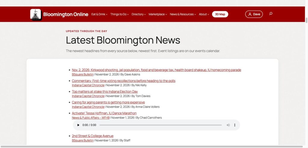
The Monday email got its new look in the last post. Since then it leads with the newest story and photos, and it asks readers to forward it to a friend. The signup form now has a bot check and flood control.
The Marketplace
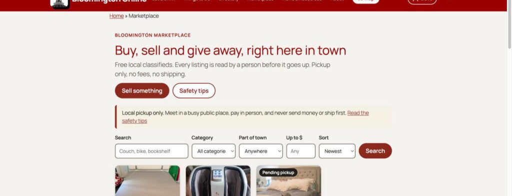
The Bloomington Marketplace is a place to buy, sell and give away things locally. It is free, for pickup only, and every listing is read by a person before it goes up. There are no accounts to create and no fees. You can search by category and part of town, or sell something with a short form. A page of safety tips covers meeting in a public place and paying in person.
More of Bloomington in 3D
The map got a lot of new buildings and places over these two weeks, and most started with photographs I took while walking around town.
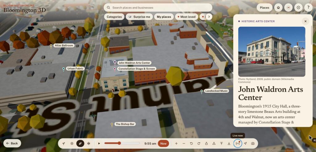
John Waldron Arts Center is Bloomington's 1915 City Hall, a limestone Beaux Arts building at 4th and Walnut. The model is built from the National Register of Historic Places nomination and has its entablature, the tablet that says CITY HALL 1915 and the double-height doorway. The card tells the story of the building, from the city offices and the fire department to the arts center it is today. It also has a listing in the directory.
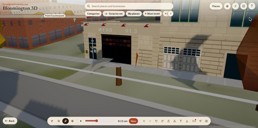
Next door is WFHB's firehouse. Using two photographs of its front, we rebuilt the old fire station with its black overhead door, WFHB 91.3 in light letters on the limestone, red gooseneck lamps, and the front door at 108 with the station's sticker and its welcome sign. The listing now shows the same photos.
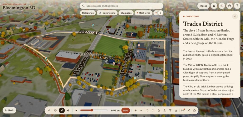
In the Trades District, we added the OT987 sculpture with its night lights, the new parking garage, the Kiln and a district walk. Last post's Forge and the Mill's glowing sign are part of the same walk. The Trades District card links all of them.
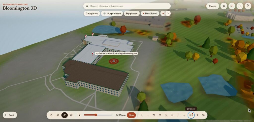
Ivy Tech Bloomington's Ferguson Academic Building, Cook Pavilion and Shreve Hall are on the map, from the college's own information and our photographs. The card explains how the campus grew from its 2002 opening to the 2015 expansion.
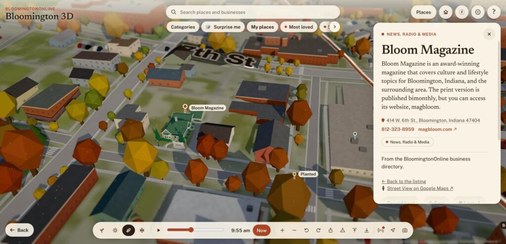
Bloom Magazine's cottage on West 6th Street was rebuilt from Street View images, with its porch, chimney and yard sign. La Charreada on North Walnut was rebuilt from photographs, down to its glass-walled dining room and slate-blue roof, and its listing now has a phone number and a photo.
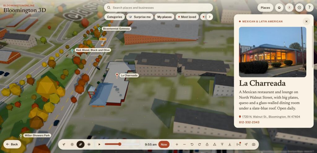
There are also new ways to explore. The map has tours for Bloomington's international markets, vegan food, the Trades District, limestone buildings, Indiana University and pickleball courts. The pickleball cards list hours, nets and access codes for each location. The limestone tour lights up its landmarks at night.
And we have blogged about a few other projects since October 19: Tour College Towns, Bob Knight Memorial Way and B-Town 500 Trivia, a free trivia race around a 3D Little 500 track.
Behind the scenes
A few changes are for the person running the site. The WordPress admin has one Site Tools menu for our own tools, and a dashboard with Needs attention and Site pulse boxes, so a reminder like the monthly photo is hard to miss. The Monday email has its own admin page with a send history, a preview and a test send.
By the numbers
- 54 updates to the 3D map went live, and more than 200 saved code changes went into the map, the site's plugins and its theme
- 2,483 businesses are in the directory, 185 of them with menu links and 209 with hours
- 91 businesses were audited for vegan food
- 6 menu groups and 36 links replaced about 50 header links
- 5 things in the Live now menu: buses, aircraft, road work, weather and water, and hot air balloons
- 10 community photos and 3 marketplace listings are up, and we would like to see far more
Where the data comes from
Live buses come from the public feeds of Bloomington Transit and IU Campus Bus. Aircraft positions are from adsb.lol, under the Open Database License. Weather is from the National Weather Service and water levels are from the U.S. Geological Survey. Road work is from the City of Bloomington's inRoads. Street names and many map details are from OpenStreetMap contributors. The international markets tour started with the Indiana Daily Student's guide. Building models are our interpretation of photographs and public records, so tell us if you see something wrong.
If you own a business here
Look yourself up in the directory and tell us what is wrong. Every page has a Suggest a correction link and an Own this business? Claim or update it button. If you have a menu link, hours, photos or a new logo to send us, this is a good week for it. If you do not have a listing yet, adding one is free.